


Home > Highlights >
Sextant
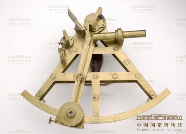
Edward Troughton (1753–1835), Sextant, London, c. 1790;
Staatliche Kunstsammlungen Dresden, Mathematisch-Physikalischer Salon
A central problem for shipping was determining a vessel's position at sea, in particular calculating longitude – a method that was not introduced until 1762. This necessitated the precise measurement of time. By comparing the prime meridian time at zero degrees longitude with the corresponding local time as determined by the position of the sun, it was possible to establish the difference in time zones. This meant navigators could calculate the geographical position of longitude by dividing the globe up into 360 degrees and corresponding time zones. Other navigational instruments that relied on astronomy included the quadrant and sextant, as shown here.